
GPR Ground Scanning & Underground Utility Survey in the UAE
Before you excavate, we survey the ground with a Proceq GS8000. Buried power cables, water and sewer lines, telecom ducts, plastic pipes, tanks and voids are painted on the ground with estimated depths, and a survey report follows within 24 hours. Dubai-based, working in all seven emirates.
- Max depth in soil
- Up to 10 m
- Typical in UAE ground
- 5–10 m
- Survey report after the visit
- 24 h
What is GPR ground scanning?
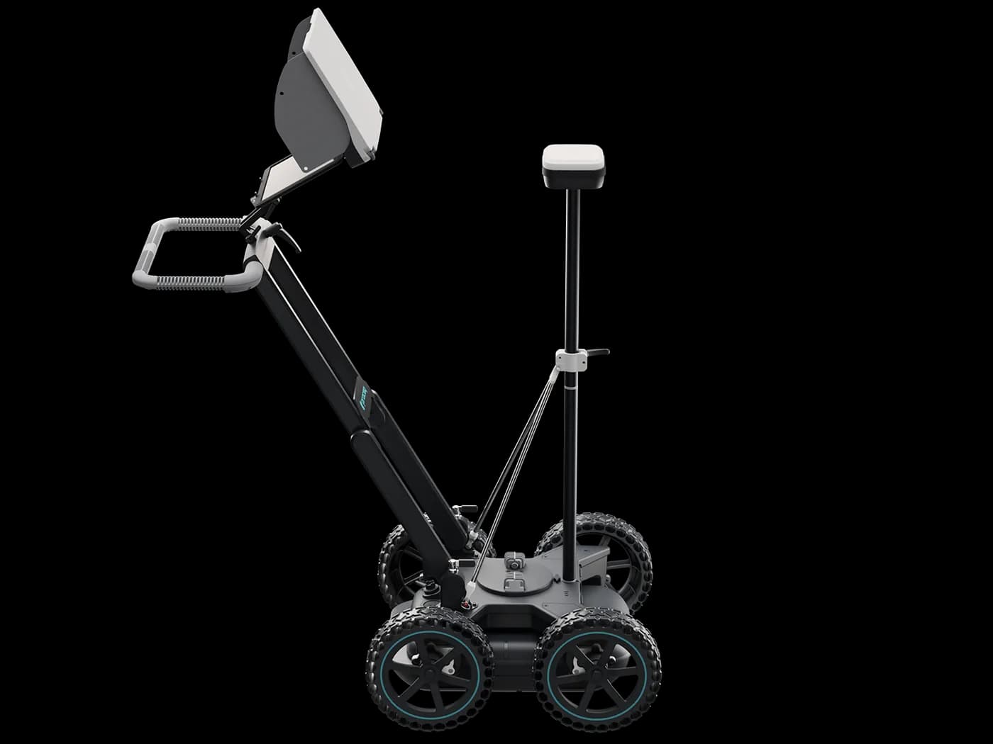
GPR ground scanning is an underground utility survey done with ground penetrating radar before anyone digs. A survey cart is pushed over the site in a grid. It sends radio pulses into the ground and records reflections from anything that differs from the surrounding soil: metal and plastic pipes, cable ducts, chambers, tanks and voids. The result is a map of what is physically in the ground, which is then checked against the authority drawings. Unlike a cable locator, radar does not need the service to carry a current, so it also finds plastic water and irrigation lines.
Agree the survey extent
Trench route, plot or open area, and the depth you plan to dig. That sets the grid spacing and the time needed.
Run the GS8000 over a grid
The cart is pushed along recorded lines in two directions so a service running in either direction is crossed and picked up.
Paint out and report
Located services are painted on the ground with estimated depths. The survey report follows within 24 hours, including any area where the ground limited the reading.
Get a price for this job
Send the site location, the element or ground, the area and your date. We call you back with a fixed price.
At a glance
- What we do
- Locate buried services and obstructions before excavation, trenching or piling
- Where
- All seven emirates, including Al Ain, from our office in Deira
- Instrument
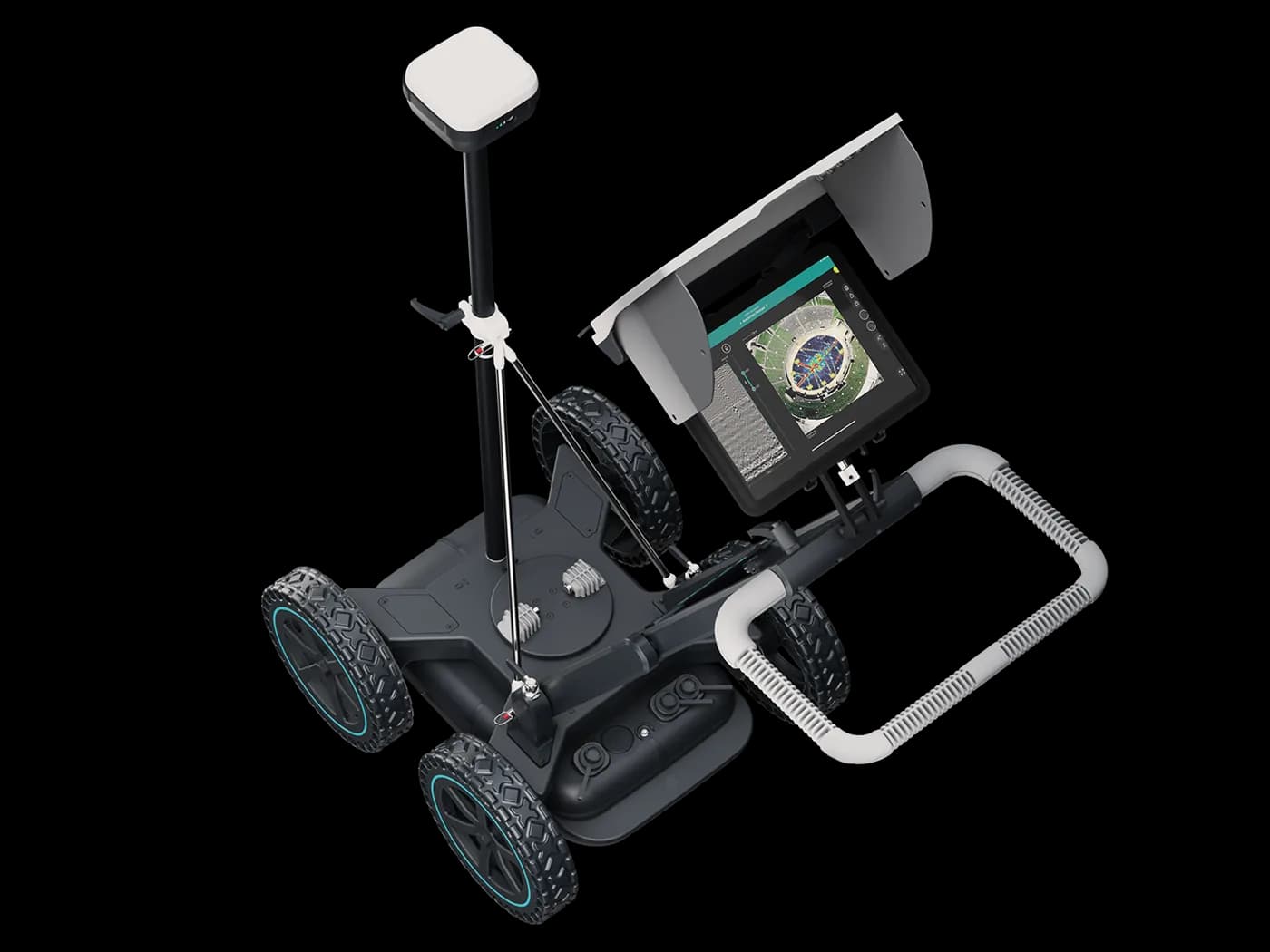
- Proceq GS8000 ground radar on a survey cart
- You receive
- Services painted on the ground with depths, survey report within 24 hours
- How quickly
- Dubai and Sharjah same day or next morning, subject to site access; Abu Dhabi usually next day; permit-to-work sites take longer
- Contact
- WhatsApp or call +971 55 692 6286. We reply within 1 hour during working hours.
What the service covers
- Metallic and plastic servicesPower, water, sewer, telecom, gas, and PVC or HDPE pipes.
- Tanks, chambers and voidsAnything that changes how and where you can dig.
- Grid coverageTwo-direction lines so services in any orientation are crossed.
- Paint-out on siteRoutes and depths marked where the excavation crew works.
- Stated depth limitsAreas the ground stopped us reading are shown, not left blank.
- Written survey reportMapped findings within 24 hours; drawings for larger sites.
- Find services that are missing from the authority drawings
- Pick up plastic pipes a cable locator cannot see
- Decide where to machine dig and where to hand dig
- Fewer trial pits, and dug in the right places
- A written record of the survey for your permit file
- Survey and excavation from the same contractor if you need it
When you need it
- Survey before excavation or trenching
- Trench route clearance for new services
- Road and car park surveys
- Plot surveys before piling or foundations
- Buried tanks, chambers and voids
- As-found service mapping of a compound
- Landscaping and irrigation works
- Yards and industrial plots with no records
Ground scanning across the emirates
We are based in Al Khabeesi, Deira, and the GS8000 is kept there. Dubai and Sharjah sites are normally attended the same day or next morning, Abu Dhabi usually next day, and Al Ain, Ajman, Umm Al Quwain, Ras Al Khaimah and Fujairah are planned visits with a day's notice. Ground conditions change a lot between them: dry sand in Al Ain and the Sharjah industrial belt reads deep, sabkha on Abu Dhabi Island and reclaimed ground at the Marina reads shallow, and wadi gravel in Fujairah scatters the signal. Each emirate page below covers what to expect.
Why survey when you already have the drawings
Each utility owner records only its own assets, to its own accuracy. Diversions made during construction, abandoned lines and private services laid by earlier occupiers are often on nobody's drawing, and ground levels change after installation, so recorded depths drift. The survey checks the drawings against what is physically in the ground, which is the record that matters when the bucket goes in. Drawings are still needed, and the survey does not replace any authority approval your site requires.
GPR survey or cable locator?
A cable locator detects the electromagnetic field around conductive services, so it is blind to plastic pipes, empty ducts and dead cables. Ground radar responds to any contrast with the soil, so it finds those too, but it does not tell you what a service is. That is why the survey is read alongside the authority records. We use the GS8000; we do not offer a cable locator sweep as a cheaper substitute.
How an underground utility survey runs
Send us the job on WhatsApp
Location or plot number, the trench length or area, how deep you will dig, what the surface is, and your date. Any authority drawings you already hold help us plan the grid.
Survey on site
The operator runs the GS8000 over the agreed grid. It is non-destructive, so it works on live roads, yards and finished compounds with only short pauses to traffic.
Paint out and brief the crew
Services are painted on the ground with estimated depths. Anything uncertain is marked as a hand-dig zone, not shown as clear ground.
Issue the report
Within 24 hours you get the survey report with mapped findings and depths, plus a marked-up drawing over your site plan for larger sites.
What you receive, and what we will not promise
What you receive
- Buried services painted on the ground with estimated depths
- PDF survey report within 24 hours with the mapped findings
- Marked-up drawing over your site plan for larger areas
- A stated depth limit wherever the ground stopped the radar
What the Proceq GS8000 cannot tell you
- Saline, wet or sabkha ground can cut usable depth below 5 m.
- Radar shows an object and its depth, not what the service is.
- Buried slabs and hard layers can hide what sits beneath them.
- Very congested service corridors are hard to separate line by line.
Where one of these limits affects your job, the report says so in writing.
Check us before you book
- Trade licence
- 844806, DED Dubai
- Registered office
- Office A-51, Al Shaikh Building 05, Al Khabeesi, Deira, Dubai, United Arab Emirates
- Instruments we own
- Proceq GP8000 (concrete), Proceq GS8000 (ground)
- Operating since
- 2019
Sites we have worked on include The Dubai Mall, Circle Mall, Yas Mall, Nakheel Mall, Kempinski Hotel, The Edition Hotel, ADNOC Headquarters, Al Dar Properties. See the project list
Need this on your site? Send the location and your date.
The instrument: Proceq GS8000
Proceq GS8000
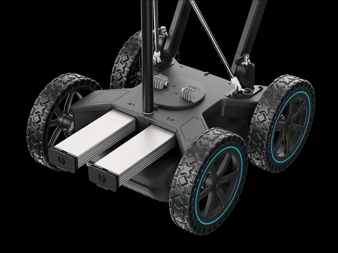
The GS8000 is a Swiss-made ground radar built for utility mapping. It sweeps a wide frequency band in one pass, so it reads shallow services in detail and still reaches deeper targets where the soil allows. It is mounted on a cart and covers roads, yards and open plots quickly. We use it only on ground. Rebar and tendons inside concrete are a different job, done with our GP8000.
- Material
- Soil, fill and hardstanding
- Maximum depth
- Up to 10 m
- Typical UAE depth
- 5 to 10 m, set by the soil
- Frequency range
- 0.2 to 3.4 GHz, stepped-frequency
- Survey method
- Cart pushed over a grid
- Finds plastic pipes
- Yes, unlike a cable locator
Depth in the ground is set by the soil, not the instrument. Dry inland sand reads deep; saline sabkha, reclaimed coastal fill and wet ground cut it short. Most services a machine will meet sit in the top 2 to 3 m, which the GS8000 reaches in almost all UAE ground. If your target is deeper than your ground allows, we tell you before you rely on the survey.
Ground scanning sites
What Our GPR Survey Report Contains
Every ground scanning job ends with a written report in the same structure, so a site engineer, consultant or safety officer can find what they need quickly. These are the sections, in order.
- CoverProject, client, date of survey and date of report, so the report can be filed against the permit or work order it supports.
- Introduction and objectivesWhy the survey was commissioned and the excavation it clears, whether a pipe route, a pool footprint or a set of trial locations.
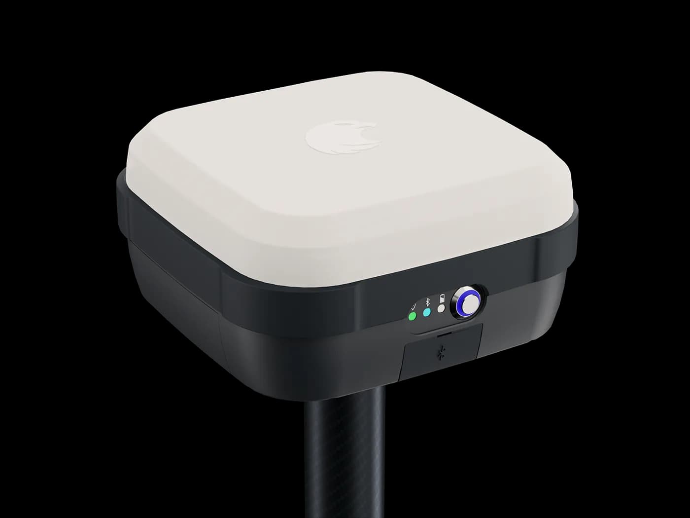
- Scope of work and equipmentThe area or routes covered and the instruments used: the Proceq GS8000 ground radar and, where positioning is recorded, the MA8000 GNSS receiver.
- Disclaimer and limitsA plain statement of what GPR can and cannot do. Wet, clay-rich or saline ground reduces depth. Small plastic pipes are harder to see than metal ones. No method finds everything, and a trial pit is recommended before any excavation.
- Scan results summaryTotal scan length, how the area was covered, the busiest zones, any stretches that could not be cleared at depth, and the recommendation for hand digging or trial pits.
- Site location and route plansWhere the scans ran, with numbered indications on the plan and, where the client supplies one, on their own drawing. Standalone GNSS positions are stated as accurate to a few metres.
- Scan images with commentsThe recorded data shown as consecutive sections along the whole scan path, each with a short written comment on what it shows. Depths are given as indicative readings on the image scale, not as surveyed levels.
Recent surveys
Real surveys from our records, with the scope and limits as reported to the client. Open a row for the detail.
in Abu DhabiCommercial kitchen, underground oven installation
Commercial kitchen equipment supplierAbu Dhabi394m24numbered on the area planNext dayissued 4 Oct 2026Indications 24Report Next day
Overlapping GS8000 passes over a 22 m × 16 m asphalt area in Abu Dhabi: 394 m of scan, 24 numbered indications, report the next day.
- Area
- About 22 m × 16 m
- Total scan length
- 394 m in three scan paths
- Indications
- 24, numbered on the area plan
- Scan images
- 16, each commented
- Report date
- 4 October 2026
Limitation stated in the reportThe last 12 m of the first scan path was noisy and was marked as not cleared.
Read the case study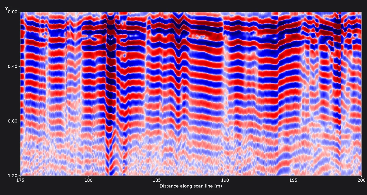
in Abu DhabiPrivate villa, new swimming pool
Swimming pool installation contractorAbu Dhabi384mNone taggedwhole grid reported section by sectionNext dayissued 1 Oct 2026Indications None taggedReport Next day
An 18 m × 32 m garden scanned with the GS8000 in two directions before a pool dig in Abu Dhabi: 384 m of scan, report issued the next day.
- Area
- About 18 m × 32 m
- Total scan length
- 384 m
- Pattern
- Grid of parallel passes in two directions
- Scan images
- 16, covering the whole grid
- Report date
- 1 October 2026
Limitation stated in the reportThe scan images represent the recorded data only. The presence and position of any buried service must be confirmed by trial pits or hand excavation before mechanical digging.
Read the case study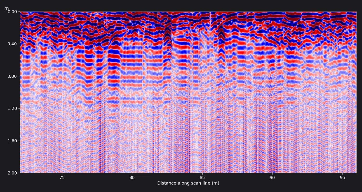
in Abu DhabiAirport infrastructure, new buried fire-protection pipework
Rebus Projects Managements, Project management contractor delivering new fire-protection pipework at an airportAbu Dhabi755m39 + 539 marked on site, 5 more found on review14 daysissued 25 Sept 2026Indications 39 + 5Report 14 days
755 m of GS8000 ground scanning on asphalt and interlock service roads at an Abu Dhabi airport: 39 points marked on site, more found on whole-line review.
- Total scan length
- 755 m
- Lines
- 2 (388 m and 367 m), one pass each
- Points marked on site
- 39
- Scan images
- 25, each commented
- Report date
- 25 September 2026
Limitation stated in the reportSome deeper readings were reported as weak and to be treated with caution, not as confirmed services.
Read the case studyDelivered
- Two branded PDF survey reports, one per line, of 21 and 16 pages.
- Reports dated 25 September 2026, fourteen days after the survey.
- 25 scan section images with written comments tying each reflection to the on-site point labels.
- Route map and detected points plotted on the client's drawing.
- A recommendation to excavate manually and slowly within the affected zones.
in Abu DhabiAirport car park works
Arts Island Contracting, Civil contractorAbu DhabiLength not on recordNot countedreflections at about 1 m and 1.8 m14 pagesissue date not on recordIndications Not countedReport 14 pages
GS8000 ground scanning of a car park area at an Abu Dhabi airport before excavation at several locations, reported in 10 commented scan images.
- Area
- Car park area outlined by the client
- Excavation
- Planned at multiple locations
- Scan images
- 10
- Report
- 14 pages
Limitation stated in the reportGround with high clay or salt content, or a shallow water table, can absorb the radar signal. The report states this limit openly.
Read the case studyDelivered
- 14-page branded PDF survey report.
- 10 scan images captured on site.
- A recommendation to excavate manually and progress slowly within the affected zones.
Where we work
We work in all seven emirates. These pages cover the areas, ground conditions and site rules in each.
GPR ground scanning: common questions
How deep can the GS8000 scan?
Up to 10 m, typically 5 to 10 m in UAE ground. Dry inland sand reads towards the top of the range. Saline sabkha, reclaimed coastal fill and wet ground can pull it below 5 m. Most services an excavator meets sit in the top 2 to 3 m. We assess the ground on site and report the depth we could actually confirm.
Can ground radar find plastic pipes?
Yes. Radar responds to the contrast between the pipe and the soil around it, not to conductivity, so PVC and HDPE water, irrigation and drainage pipes show up. A cable locator cannot see them. Detection is harder in very wet or mixed ground, and the report says where that applied.
Do I still need a survey if I have DEWA or Etisalat drawings?
Yes. Authority drawings show each owner's own assets as designed or recorded at installation. They miss diversions, abandoned lines and private in-plot services, and recorded depths drift as ground levels change. The survey checks the drawings against the ground. It does not replace any approval or NOC your site needs.
Can radar tell us what each service is?
Not on its own. It gives position, depth and an indication of size, but not whether a line is water or telecom. Identification comes from reading the survey against the authority records and what is visible on site, such as chambers and markers. Where a service cannot be identified, it is marked as unknown and treated as live.
What is the difference between the GS8000 and the GP8000?
The GS8000 scans the ground for buried services before excavation, up to 10 m depending on soil. The GP8000 scans inside concrete for rebar, post-tension tendons and conduits before cutting, up to 1.5 m. They are separate instruments for separate jobs. We own both.
Does a survey guarantee we will not hit anything?
No, and nobody should promise that. Radar has real limits in saline or saturated ground and in congested corridors. A survey removes the unknowns it can see, states where the ground limited it, and gives you a documented basis for how you dig. Safe digging practice, including hand digging near marked services, still applies.
How much does an underground utility survey cost?
It depends on the survey area, grid spacing, surface condition, working hours and whether you need marking only, a report, or a drawing. A trench corridor or a single plot is usually a fixed price for the visit. Send the location, area, dig depth and date on WhatsApp and we will quote before we come.
How long does a utility survey take?
A trench corridor or a single plot is usually surveyed and painted out within a few hours. Road sections, compounds and open sites are scoped by area and can take a day or more.
Related guides
- Ground scanning, 8 min readUnderground utility survey before excavation in Dubai: NOCs, DEWA, du and Etisalat
NOCs tell you what the service owners know about. A survey tells you what is in the ground. Why a Dubai excavation needs both, and in what order.
- Ground scanning, 7 min readGPR ground scanning vs trial pits: which one, and when you need both
A trial pit tells you exactly what is at one spot. Radar tells you roughly what is everywhere. The question is not which one, but in what order.
- Working with us, 7 min readWhat is in a GPR survey report, and how to read one
The marks on site get the job done today. The report is what your consultant, your permit and your file keep. What it should contain, and what to question.
- Ground scanning, 6 min readBefore you dig: utility surveys on UAE sites
Utility records from separate authorities rarely agree with each other, let alone with the ground. What a survey adds, and what it honestly cannot do.
- Ground scanning, 6 min readHow deep GPR really reads in UAE ground
Every equipment brochure quotes a maximum. What you get depends on moisture and salinity — and the UAE has both extremes within an hour of each other.
- Ground scanning, 7 min readGPR vs electromagnetic cable locators underground
A cable locator cannot see a plastic water pipe. Radar cannot label what it finds. The two instruments answer different questions and are strongest together.
Need the ground surveyed before you dig?
Send the location, area and dig depth. We reply within 1 hour during working hours with a price and a date.
We reply within 1 hour during working hours. Email Bhadeyatechnical@gmail.com